
We Are a Team of Qualified Professional BC Land Surveyors and Engineers.

Monashee Surveying and Geomatics consists of qualified Professional BC Land Surveyors and Professional Engineers and technical staff delivering knowledge-based, value added, technical solutions to our clients.

About Our Company

Monashee Surveying and Geomatics was formed in 2003 to meet the needs of both the private and public sectors. Our clients rely on us to deliver first rate, world-class technical solutions that optimize their assets, improve their competitive position and increase their long-term success.

Our principals and employee’s have been involved the surveying industry for over 25 years and have worked extensively with clients on land development projects from initial concept through to final registration of the legal survey plans. We provide consulting, planning, geomatics and related services to clients involved in resource, infrastructure, environmental and land development projects.

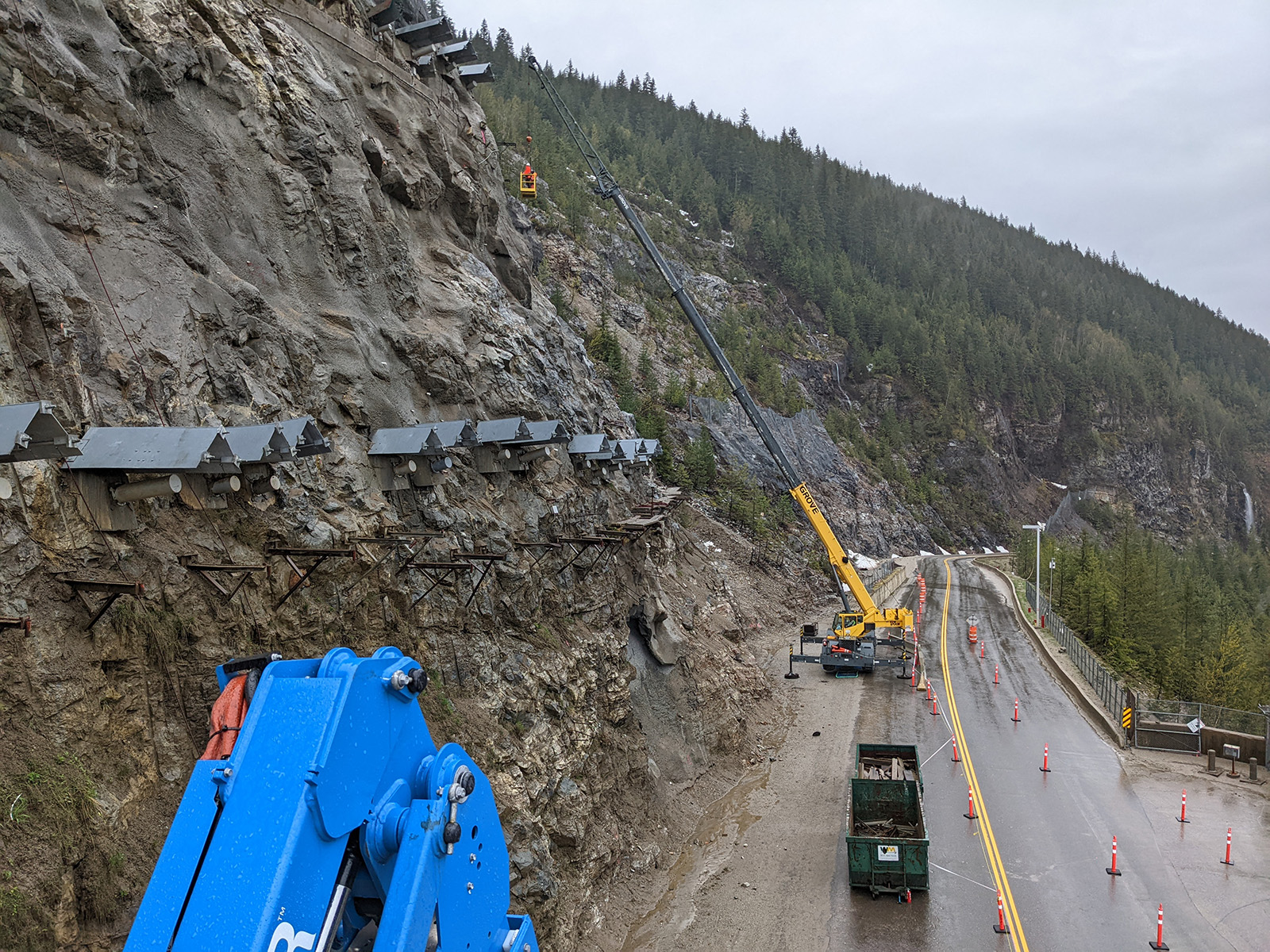
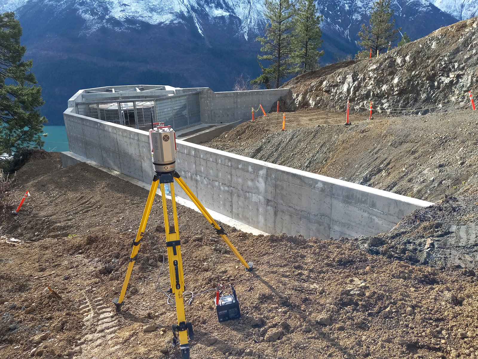
At Monashee Surveying and Geomatics, we are continuously reviewing and investing in new and existing technologies that are consistent with our core strength; surveying and geomatics knowledge.

Health and Safety

Monashee Surveying and Geomatics is committed to a safe and healthy workplace.  We recognize that our staff members are our most valuable asset.  To this end, we have instituted policies and programs to deal with issues of health, workplace safety and environmental stewardship that help manage how we carry out our business on a day to day basis.

All our employees have completed safety training specific to their workplace environments.

Environment

The impact of development on our environment and its physical and natural features is undeniable.  Monashee Surveying and Geomatics will organize and manage our operations and activities in a manner that demonstrates care and respect for the environment. Our overall goal is to prevent environmental harm in all our activities.

We are committed to operating in an environmentally responsible manner and believe that responsible stewardship of both the natural and the built environment is essential for business efficiency and success.

Our Services

Monashee Surveying and Geomatics provides surveying and geomatics engineering services throughout British Columbia.  Our projects range from small conventional land surveying projects to very large scale infrastructure projects in all corners of the province.

Our expertise in land surveying and geomatics engineering has been built up over many years on surveying and engineering projects for both private and public sector clients across a wide array of industries.

Land Development

  • Development, land use, and zoning applications
  • Subdivision applications
  • Government and regulatory body liaison
  • Site planning
  • Subdivision and neighborhood design

Land Surveying

  • Legal or cadastral surveys
  • Geodetic control surveys
  • High Precision Leveling
  • Photo control surveys
  • Site surveys
  • Topographic surveys
  • Construction surveys
  • Mineral exploration surveys
  • Earthwork quantities

Global Positioning

  • Static, Kinematic and Real-Time GPS surveys
  • Conventional GPS positioning for survey control and photo control.
  • GPS data acquisition related to lengthy linear projects highways, power lines, oil and gas pipelines, and other statutory rights of ways.
  • Topographic surveys utilizing Real Time kinematic techniques
  • GPS data acquisition for land development, infrastructure or oil and gas projects
  • Data acquisition for municipal, regional, provincial and federal GIS applications

Mapping

  • Consultation on photo mosaics, including orthoimagery 
  • Contour maps 
  • Composite legal plans 
  • Topographic, cadastral, thematic mapping

Laser Scanning

  • Quality control and inspection
  • Production design and engineering
  • As built capture and modeling
  • Historic preservation
  • Safety Planning
  • Deformation monitoring

Drone

  • Inspection of power lines and pipelines
  • Landslide measurement
  • Contour Maps
  • Ortho Imagery

Office Location:
Monashee Surveying and Geomatics
3710A 28th Street, Vernon, B.C., V1T 9X2
P: 250-545-5990
E: admin@monasheesurveying.com

Contact Us

© Monashee Surveying and Geomatics 2022. All rights reserved.